In the realm of modern surveying, the total station stands as a cornerstone instrument, renowned for its versatility and precision. As a dedicated total station supplier, I’ve encountered numerous inquiries regarding its suitability for geodetic surveying. Geodetic surveying, a specialized branch of surveying, deals with the measurement and representation of the Earth’s shape, gravity field, and the precise positioning of points on its surface. It plays a pivotal role in various large – scale projects, including mapping, infrastructure construction, and scientific research. So, can a total station be used for geodetic surveying? Let’s delve into this question in detail. Total Station

Understanding the Total Station
A total station is an electronic/optical instrument used in modern surveying. It combines an electronic theodolite for measuring angles (both horizontal and vertical) with an electronic distance meter (EDM) to measure distances. Additionally, it often has a data collector that can store the measured data, and some advanced models are capable of performing complex calculations in real – time.
The key features of a total station make it highly attractive for a wide range of surveying applications. Its ability to measure angles and distances with high accuracy allows surveyors to determine the relative positions of points on the ground. For example, in a construction site, a total station can be used to set out building corners, check the alignment of structures, and monitor the deformation of buildings over time.
The Demands of Geodetic Surveying
Geodetic surveying is different from other types of surveying in that it takes into account the curvature of the Earth. When dealing with large – scale areas, the flat – surface assumptions used in plane surveying are no longer valid. Instead, geodetic surveyors must use mathematical models to represent the Earth’s shape, such as the ellipsoid.
The requirements for geodetic surveying are extremely stringent. High – precision measurements are needed to accurately determine the coordinates of points on the Earth’s surface. These coordinates are often referred to a global or regional geodetic datum, which provides a consistent reference framework. Geodetic surveys also require long – range measurements and the ability to correct for various error sources, including atmospheric refraction, instrument errors, and the effects of the Earth’s gravitational field.
Using a Total Station for Geodetic Surveying
Advantages
- Accuracy: Modern total stations are capable of achieving high levels of accuracy in angle and distance measurements. For short – to medium – range geodetic surveys, especially in areas where the terrain is relatively flat, a total station can provide sufficient precision. For example, in a local geodetic control network establishment in a small city, a total station can be used to measure the distances and angles between control points with millimeter – level accuracy in good observation conditions.
- Versatility: Total stations can be used in various field conditions. They can be set up quickly and are relatively easy to operate. This makes them suitable for both static and dynamic geodetic surveying tasks. In a construction project, a total station can be used to monitor the deformation of a bridge during the construction process, continuously measuring the positions of specific points on the bridge structure.
- Data Collection and Processing: Total stations usually come with data collectors that can store a large amount of measurement data. This data can be easily transferred to a computer for further processing. Many software packages are available that can handle the data collected by total stations and perform geodetic calculations, such as coordinate transformation and adjustment.
Limitations
- Earth’s Curvature: As mentioned earlier, geodetic surveying must account for the Earth’s curvature. For long – range measurements, the error caused by ignoring the Earth’s curvature can be significant. A total station, which is based on line – of – sight measurements, has limitations in this regard. In a large – scale geodetic project covering hundreds of kilometers, the curvature of the Earth will cause the measured straight – line distances to deviate from the actual geodetic distances.
- Atmospheric Effects: Atmospheric refraction can significantly affect the accuracy of total station measurements. The refraction of light in the atmosphere changes the apparent direction and distance of the measured points. In geodetic surveying, where high – precision results are required, these atmospheric effects need to be carefully corrected. Total stations are sensitive to these effects, and correcting for them accurately often requires additional meteorological data and complex correction models.
- Range Limitations: The effective range of a total station is limited. Most total stations have a maximum range of a few kilometers, which may not be sufficient for large – scale geodetic surveys. In large – area geodetic mapping projects, such as mapping an entire province or a large desert area, the limited range of a total station makes it difficult to complete the survey efficiently.
Complementary to Other Geodetic Instruments
Despite its limitations, a total station can be an important part of a geodetic surveying toolkit when used in combination with other instruments. For example, Global Navigation Satellite Systems (GNSS), such as GPS, are widely used in geodetic surveying. GNSS can provide accurate three – dimensional coordinates directly, regardless of the Earth’s curvature and long distances. However, GNSS has its own limitations, such as its susceptibility to signal blockage in urban areas or under dense vegetation.
A total station can be used to supplement GNSS measurements. In areas where GNSS signals are weak or unavailable, a total station can be used to measure the relative positions of points. For instance, in a deep valley or inside a large building, a total station can be used to establish local control points, which can then be related to the global coordinate system through GNSS measurements at more open locations.
Real – World Applications
In many real – world geodetic surveying applications, total stations have proven their value. In engineering projects, such as the construction of large dams and high – rise buildings, total stations are used to ensure the accurate positioning of structures. During the construction of a dam, a total station can be used to monitor the deformation of the dam body in real – time, detecting any potential safety hazards.
In small – scale geodetic control network establishment, total stations are often the primary instrument. For example, in a local mapping project of a small town, a total station can be used to measure the distances and angles between a series of control points, which form the basis for the subsequent mapping work.
Conclusion
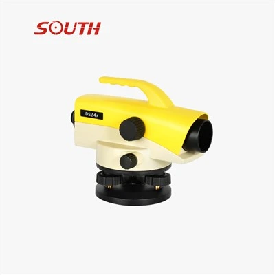
So, can a total station be used for geodetic surveying? The answer is yes, but with certain limitations. A total station can be a valuable tool in geodetic surveying, especially for short – to medium – range, local – scale projects. Its high accuracy, versatility, and ease of use make it suitable for many geodetic tasks. However, for large – scale geodetic surveys that cover long distances and require highly accurate results, it needs to be used in combination with other geodetic instruments, such as GNSS.
Hi-Target As a total station supplier, I understand the importance of providing high – quality instruments and professional support to surveyors. Our total stations are designed to meet the diverse needs of different surveying applications, including those relevant to geodetic surveying. We continuously invest in research and development to improve the accuracy and performance of our products.
If you are involved in geodetic surveying or other surveying projects and are looking for a reliable total station, we invite you to contact us for further discussion. Our team of experts is ready to provide you with detailed information and advice on choosing the most suitable total station for your specific requirements. We are committed to helping you achieve accurate and efficient surveying results.
References
- Wolf, P. R., & Ghilani, C. D. (2006). Elementsof Photogrammetry with Applications in GIS. McGraw – Hill.
- Mikhail, E. M., Burkholder, G. M., & Grodek, J. B. (2001). Introduction to Modern Photogrammetry. Wiley.
- Tsakiri – Sotiriou, E. (2011). Geodesy and Geoinformatics: Theoretical and Methodological Aspects. Springer.
Shandong Surveying Information Technology Co., Ltd.
As one of the most experienced total station manufacturers in China, we have world-leading production equipment and strong manufacturing capabilities. Please feel free to buy high quality total station for sale here from our factory. We also accept customized orders.
Address: No. 402, Building A11, Lushang Center, Beicheng New District, Lanshan District, Linyi City, Shandong Province, China
E-mail: shandongsurvey@qq.com
WebSite: https://www.nmpsurveying.com/
